The Map as a Mental Model
The core objective of this guide is to deconstruct the hegemonic visuality of the 16th-century world map—a navigation tool that has metastasized into a standard classroom fixture, inadvertently codifying a biased global worldview. As critical geographers, we recognize that a map is never a neutral reflection of reality; it is a mental model that dictates the “geopolitical imaginary” of students from their earliest years of schooling. By distorting the scale of continents, maps influence how the power, agency, and place of diverse civilizations are internalized.As the “Correct the Map” campaign articulates in its core philosophy:”A fair world begins with a fair map.”When our primary visual tools marginalize the Global South, they perpetuate a form of cartographic silencing . To dismantle this bias, we must first analyze the technical “structural flaws” that transformed a revolutionary maritime aid into a pillar of Eurocentric hegemony.
Africa Is Massive (and Greenland Is Tiny)
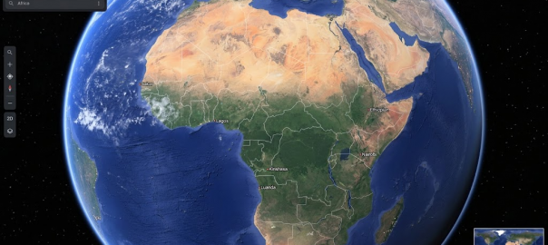
The most egregious distortion of the traditional Mercator projection lies in its treatment of area. Because the projection must stretch the Earth to preserve straight lines for navigation, it grants excessive “visual weight” to high-latitude landmasses like Europe, North America, and Russia, while shrinking equatorial regions.This creates a pervasive illusion where Greenland and Africa appear roughly identical in size. In physical reality, Africa is approximately 14 times larger than Greenland. By shrinking the African continent, the Mercator projection makes the cradle of humanity appear peripheral and diminished. This visual shrinking of the Global South is not a minor error; it is a structural bias that affects how every student perceives a continent’s global scale and geopolitical weight.”For centuries, the Mercator projection distorted global geography, shrinking Africa to the size of Greenland when our continent is actually 14 times larger.”
The United Nations Vote Was a Rare 164-to-1 Moment
The passage of Resolution A/80/L.104 was characterized by a startling level of international consensus. On September 4, 2026, 164 nations voted in favor of rebalancing the world’s visual representation. In a moment of stark diplomatic isolation, the United States was the only nation to vote against the resolution, while six other nations chose to abstain.The debate revealed a fundamental clash of worldviews. The Africa Group, led by Togo, argued that the move was a necessary act of scientific accuracy and fairness, essential for decolonizing geography curricula. Conversely, Washington dismissed the resolution as an “ideological agenda,” claiming it distracted the UN from “traditional challenges of international peace and security.” This lopsided vote, however, demonstrated that the rest of the world increasingly views cartographic accuracy as a matter of justice rather than just a technical preference.
The Mercator Map Wasn’t Built for Classrooms
As a geospatial historian, I must emphasize that Gerardus Mercator was not a villain, but a revolutionary. His 1569 projection was a technical triumph designed for the “unification of geographical and marine mapping.” It was built specifically for maritime and aerial navigation because it preserves “conformality”—the preservation of direction and the shape of small regions—allowing sailors to plot straight courses on a flat surface.The “Mercator problem” is actually a problem of misapplication. Mercator never intended for his specialized navigation tool to become the standard for general education or for comparing the surface area of continents. When we use a tool designed for 16th-century sailors to teach 21st-century children about global importance, it ceases to be a scientific instrument and becomes an ideological sham. The controversy isn’t about the map itself, but our refusal to put it back in the cockpit where it belongs.
The “Equal Earth” Projection Is the New Global Standard
To correct these historical distortions, the UN resolution promotes the “Equal Earth” projection. Created in 2018 by cartographers Tom Patterson, Bernhard Jenny, and Bojan Šavrič, this projection was specifically engineered to meet the needs of those seeking a fair representation of the world without sacrificing aesthetic appeal.Equal Earth is the sophisticated successor to the controversial Arno Peters (Gall-Peters) map. While both are “equal-area” projections that show landmasses in their true relative proportions, the Gall-Peters map was long criticized for its extreme vertical elongation, which made tropical regions look like “long underwear on a line.” In contrast, the creators of Equal Earth drew inspiration from the aesthetically pleasing Robinson projection, utilizing a “pseudocylindrical” shape that mimics the Earth’s curvature. By combining mathematical rigor with visual balance, Equal Earth avoids the technical “Gish gallop” of nonsense often associated with earlier radical projections.”A fair world begins with a fair map.”
Maps Are Not Neutral Scientific Tools—They Are Political Statements
The history of cartography is inextricably linked to the history of power. Consider the “Arno Peters phenomenon.” Peters was not a cartographer by trade; he was an art historian whose doctoral dissertation focused on “film as a means of public guidance”—essentially, film as propaganda. He understood better than anyone that the “Mercator-image” served a Eurocentric worldview. While academics viewed Peters as a charlatan for his technical inaccuracies, his message resonated because it exposed the fact that the choice of a map is always a political act.Togo’s Foreign Minister, Robert Dussey, has framed the “Correct the Map” initiative as an act of “reparation” for colonial legacies that visually diminished the Global South. Togo is already leading by example, pledging to replace all school geography materials with the Equal Earth projection by the end of 2026. This shift acknowledges that the way we represent the world is a choice that determines whether we view the Global South as an equal partner or a peripheral neighbor.
Conclusion: A New Way of Seeing
Resolution A/80/L.104 is a voluntary measure. Its success hinges not on the mandates of the UN, but on the adoption of these standards by tech giants, educational publishers, and global media. As Togo begins updating its textbooks to reflect the Earth’s true proportions, the global community is being challenged to abandon the comfortable distortions of the past.How would your own worldview change if you finally saw the continents in their true proportions? When we stop shrinking half the world, we may find that a more balanced understanding of our shared global reality finally becomes possible.